-
- Difficulty: medium
- Distance: 18.1KM
- Climb: 736.7M
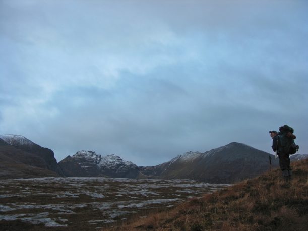
A relatively easy day, with the majority of the journey on clear paths. As you climb from Shenavall you'll be rewarded with panoramic views of the saw toothed ridge of An Teallach. (average walk: 1 day)
View the route on Ordnance Survey
Download GPX fileThere are no truly easy legs of this walk, but this one is a bit more forgiving than most. It's a tough start as you haul up from Shenavall (assuming you stayed there or camped in Strath na Sealga - otherwise you could take the 4x4 track from NH 090 787 up and over directly towards Corrie Hallie).
Your reward is stunning views of Loch na Sealga and the An Teallach ridge as you cross rough, boggy ground until you reach the 4x4 track that takes you all the way to Corrie Hallie. There's not much here, a post box and the possibility of tea and cake in the summer months. Dundonnell is close and has some accommodation options.
A steep hack of a climb takes you up through woods and on a clear but rough path over to the slippery descent down towards civilisation, and the A835. From here it is a kilometre north on the road to Inverlael.
If you're planning to avoid Ullapool and stay around Inverlael, there are a few B&Bs relatively nearby (see the accommodation section). If you mention that you'll be arriving at Inverlael on foot, some will offer a collection and drop off service and save you a slog along the road.
The Ullapool conundrum
Ullapool is a natural halfway point on the trail and makes a good spot to re-charge the batteries or break the route. Hitting the tarmac at the A835 brings you back to civilisation with a jolt and presents a dilemma. Do you stay on the main route or divert to Ullapool?
The town has a decent range of accommodation, a fair selection of shops and restaurants and a beautiful location, strung along the shore of Loch Broom. With sufficient supplies you could simply continue from Inverlael towards Oykel Bridge, spurning civilisation altogether.
If you choose to visit Ullapool, the only way to get there (now that the ferry that used to make the crossing from the Altnaharrie Inn no longer operates) is to brave a long slog along the A835 (there are no bus stops). There is a verge, but not much pavement and at sometimes of day traffic thunders past at regular intervals making it a hair raising experience. If there's any chance you may be walking the road in twilight or darkness, make sure you have appropriate reflective gear.
Walker Amy Lauterbach suggests a parallel road/track that runs for a good part of the A835, meaning you can avoid the main road. Please see this kml file (load into Google Earth and you can compare it to the main road).
Another option is to try to thumb a lift or call a taxi from Ullapool to collect you from the roadside at Inverlael (the phone box has a car park next to it which is a good landmark). The taxi fare is around 15; arrange it in advance with Ewen's, 01854 612966). On your return, buses travelling out of Ullapool will usually stop at Inverlael on request.
Instead of returning to Inverlael you could use the alternative route that leaves from the back of town and winds pleasantly along the Ullapool and Rhidorroch rivers before rejoining the main route near Knockdamph bothy (NH 286 954) - see route alternatives in the next leg.
For the truly adventurous, you could follow in Paterson's footsteps and strike out from Ullapool into the dark heart of Assynt - for more information see this blog post.
Share this
- blog comments powered by Disqus

The book
A comprehensive guide to the Cape Wrath Trail, one of the most challenging long distance walks in the UK, published by Cicerone and now in a fully updated Second Edition.
Buy the book
A comprehensive guide to the Cape Wrath Trail